This website is about climbing Mt. Fuji, the highest mountain in Japan and on this website can be found detailed information on hiking trails of Mt. Fuji during the summer season (July-August), which is the major popular season for climbers and preparation for required mountaineering clothing, equipment and items.
It also offers a little information about climbing Mt. Fuji in winter. (The difficulty of climbing Mt. Fuji in winter is considered to parallel the one of climbing Everest.)
Since a number of websites that offer detailed information on Mt. Fuji are majorly written in Japanese, the access to those information is very much limited for people who don't understand Japanese.
This website shall be very much helpful in planning on safe climbing to the top of Mt. Fuji.
Basic facts about Mt. Fuji
Altitude: 3,775.63 m (12,389 feet)
The Highest Peak: Kengamine peak
The Number of Climbers during the Summer: Approximately 300,000 people
– Mt. Fuji is an outstandingly beautiful mountain in Japan.
– Due to its popularity among climbers, the trails are well maintained.
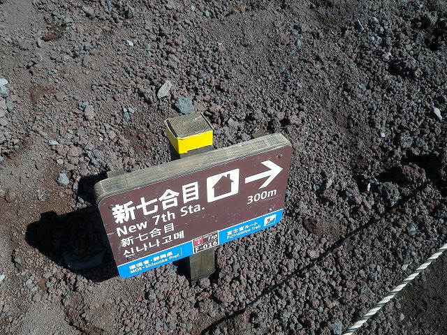
– Trail signs are available in English and Korean as well.
Trails of Mt. Fuji
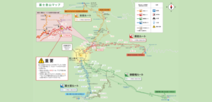
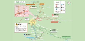
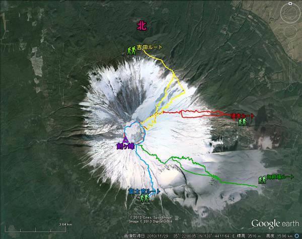
There are four major routes for reaching the top of Mt. Fuji. (There are several others as well.)
| Comparison of routes for climbing Mt. Fuji | ||||
| Climbing route |
The starting point |
Walking distance |
Required Time (excluding breaks) |
the number of hut |
|
Yoshida trail (Kawaguchiko trail) (photo: yellow) |
2,305m |
Total: 15.1km Ascent: 7.5km Descent: 7.6km |
Ascent: about 6 hours Descent: about 3 hours and 20 minutes |
18 |
|
Fujinomiya trail (Photo: blue) |
2,400m |
Total: 10km Ascent: 5.0km Descent: 5.0km |
Ascent: about 5 hours Descent: about 2 hours and 40 minutes |
9 |
|
Subashiri trails (Photo: red) |
2,000m |
Total: 14km Ascent: 7.8km Descent: 6.2km |
Ascent: about 5 hours and 40 minutes |
12 |
|
Gotemba trail (photo: green) |
1,440m |
Total: 19.5km Ascent: 11.0km Descent: 8.5km |
Ascent: about 7 hours and 30 minutes Descent: about 3 hours and 10 minutes |
5 |
*As shown in the figure, the altitude of the 5th station on each climbing route is quite different.
There seem to be no clear criteria for identifying the point of the 5th station.
*Required time on each route does not include break time.
It’s better to add several hours to the estimation, for one would inevitably end up taking fairly large amount of resting time near a hut.
Particularly, in the case of waiting for the catch of the sunrise and such, the time amount will further extend.
Trail Map
- Mt. Fuji CLimbing Map [Fuji_Climbing_Map_E.pdf]
- Yoshida Trail Map [Yoshida_Trail_E.pdf]
- Fujinomiya Trail Map [Fujinomiya_Trail_E.pdf]
- Subashiri Trail Map [Subashiri_Trail_E.pdf]
- Gotemba Trail Map [Gotemba_Trail_E.pdf]
Weather at Mt. Fuji
Compared to other alpine mountains overseas, Mt. Fuji is not much high as the altitude is approximately 3,776m (12,389 feet).
A number of climbers from other countries have been seen in recent years, however, among whom many are not adequately equipped.
Unless the weather is in a proper condition, it can be a very challenging tough situation if worsen.
The characteristics in the difficulty of climbing Mt. Fuji are driving rain, high wind, and lightning stoke.
Above the forest line, basically rains would be sweeping slanted.
Subashiri trail near the 7th station, in 2010
Subashiri trail near the 8th station, in 2011
As illustrated in the two videos above, rains are falling almost parallel to the incline.
Slanting rain would drive into one’s eyes and critically reduce one’s visibility.
Big wind would quickly lower one’s body temperature and induce hypothermia.
Lightning stoke is very dangerous. One would be stuck in the situation of being in lightning bolt.
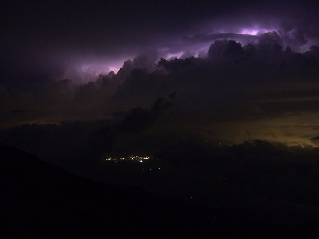
A photo of lightning visible from Mt. Fuji
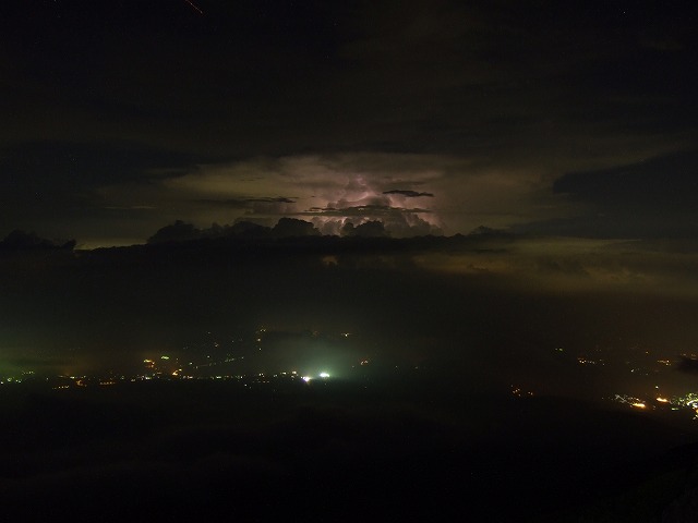
Another photo of lightning visible from Mt. Fuji
One would be struck by unworldly thunder burst and light (when facing lightning, lower the posture of the body and evacuate immediately to a hut near around! There have been deaths caused by lightning stoke in the past.)
◎ A dead body of a male on a creek near the 6th station. (December 10, 2011)
– A Fujiyoshida staff discovered that an adult male had died on a creek near the 6th station of Yoshida-guchi trail around 1:15 p.m on the 10th of December.
– The team of staffs was searching for a college student of Odawara-city who had been missing since the 4th.
– It turned out that the dead body seemed to belong to a different person than the college student. The height of the body was about 195 cm and the color of hair was brown. The body had a mustache and a possibility is that the body was a foreigner's. Some items that had been found with the body were a dark blue jumper, trousers and brown mountaineering boots. Other items such as a backpack were not found.
– Investigation is carried out suspected that the person slipped down on the climb.
Lightning does not occur so often, but big winds and heavy rain could occur very frequently.
Thus, checking the weather before climbing is vitally important.
When facing the bad weather, courage for the decision to descend is necessary. (I also have my personal experience that I had to give up on reaching the top because of strong winds shaking my body and heavy rain reducing the visibility to almost zero.)
A lack of preparation in climbing Mt. Fuji has induced quite a large number of accidents for climbers from overseas.
Accident of foreign climbers
The following is a list of accidents of foreign climbers that have actually occurred.
◎ A dead body of a male on a creek near the 6th station. (December 10, 2011)
– A Fujiyoshida staff discovered that an adult male had died on a creek near the 6th station of Yoshida-guchi trail around 1:15 p.m. on the 10th of December.
– The team of staffs was searching for a college student of Odawara-city who had been missing since the 4th.
– It turned out that the dead body seemed to belong to a different person than the college student. The height of the body was about 195 cm and the color of hair was brown. The body had a mustache and a possibility is that the body was a foreigner's. Some items that had been found with the body were a dark blue jumper, trousers and brown mountaineering boots. Other items such as a backpack were not found.
– Investigation is carried out suspected that the person slipped down on the climb.
◎ Rescues for foreigners one after the other (July 7, 2010)
– Around 10pm on July 7th, a rescue was requested to a prefectural police department for two Malaysian males (19 and 20 years-old) who were no longer able to walk in exhaustion on the hike near the 7th station of Gotemba-guchi trail.
– In four hours, police mountain rescue team found the two who were shaking in some space under the eaves of a hut. Luckily there was no threat to their lives.
– The two got lost in the condition of strong-wind and heavy-rain. They were lightly equipped merely wearing a wind-jacket.
(The second case)
– An 84 years-old American male who was on his way of descent became unable to walk in exhaustion near Subashiri trail on the night of July 7th. Rescued safely.
◎ An American male slipped down a slope of Yoshidaguchi trail at its 7th station. No life threat to his life. (June 12, 2010 Sat.)
– Around 8:50 pm on June 12, an emergency call was made after the accident of an American doctor(52 years old) slipping down a slope.
– Around 5am on June 12, a group of 4 people including him, his two children and a friend of his child started climbing.
– He slipped down 20 meters on a slope. got rescued by another group of foreigners nearby at the mountain lodge “Horaikan” at 8th station.
– On June 13, picked up by a helicopter “Akafuji” of prefectural department of fire and disaster prevention and got transported to a hospital in Kofu city. was complaining of a pain in his shoulder and his back, but there was no life threat to him.
◎ Heart arrest at the 8th station of Yoshidaguchi trail. Resuscitated by AED. (August 7, 2008)
– Around 8pm on August 7, A pair of foreign men found a fallen man (from Saitama Prefecture, 56 years old) near the hut "Taishikan" at the 8th station
– Report was made to First-aid station at the 8th station and doctors of a hospital in Fujiyoshida city worked on him.
– He was in a state of heart arrest. An AED, which was installed at the hut “Taishikan”, allowed for the restoration of his breathing and pulse in about two minutes. Recovery of consciousness as well. Taken to a hospital by ambulance, and on the mend.
· AED had been deployed at more than 14 huts above the 7th station of Yoshidaguchi trail since the previous year. This was the first case where a life of climbers was saved by the help of AED.
– A doctor who was in charge said, "it is almost miraculous that a person was saved from heart arrest in mountains. This can be attributed to the hard work of people at those mountain huts establishing relief systems including AED deployment.
◎ Rescue of missing foreigners (July 17th, 2010 Tue)
A report from Gotemba police department
(1)
– Around 1:10am on the morning of June 17th, an Australian female (62 years old) and her daughter (31 years old) who were no longer able to walk were rescued near the 7th station of Yoshidaguchi trail.
– Around 10am on May 16th, they started climbing on Yoshidaguchi trail.
– They were on the way down after reaching the top. But since they didn’t have their lighting gear, they were asking for help near the 7th station.
(2)
Two males of American college students (22 years old) were discovered around 3 am on July 17th, who got lost near the 6th station of Yoshidaguchi trail.
– Both were escorted to the police station of Fujiyoshida police department at the 6th station.
These accidents reported on articles are the big ones and there should be far many more including minor ones.
Accident in a foreign land should cause a lot of anxiety due to those things such as the difference of language.
That is why careful information gathering and preparation in advance are highly significant!
Message to people from other countries
Checking the weather in advance and preparation for proper equipment will allow for your enjoyable climbing of Mt. Fuji.
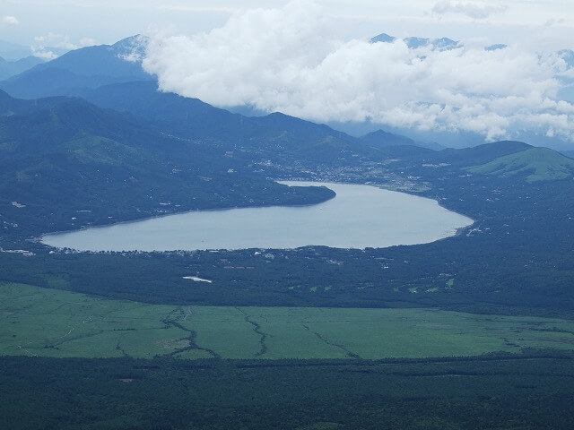
The view from a point near the summit of Mt. Fuji
Magnificent scenery
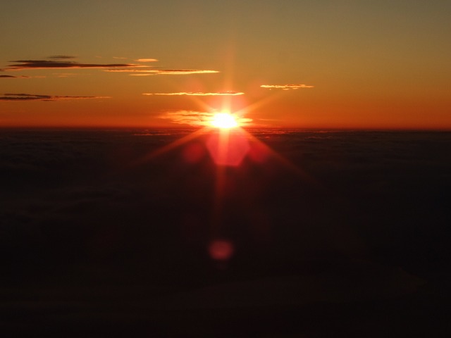
Sunrise from a point near the summit of Mt. Fuji
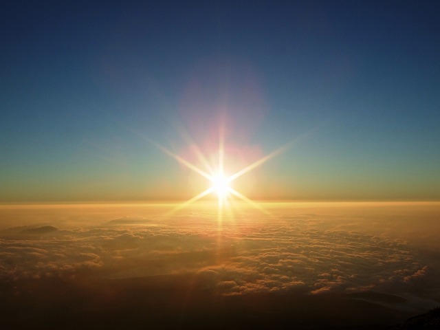
Sunrise from a point near the summit of Mt. Fuji
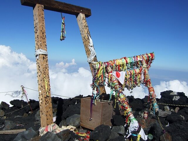
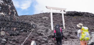
A shrine gate at Mt. Fuji
Climbing Mt. Fuji at night
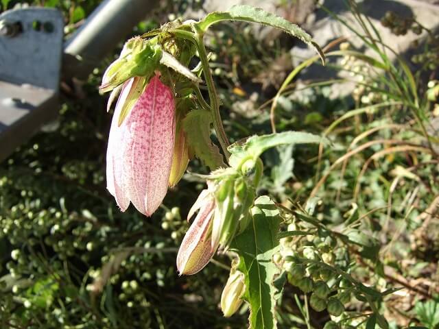
Alpine plants of Mt. Fuji
Views from Mt. Fuji are very refreshing and outstandingly extraordinary! ! !
I sincerely hope that you can safely enjoy your climbing of Mt. Fuji! !
If you want to see this website in other languages ⇒ click here!!! (Please choose a language!)
P.S
It would be my great pleasure if this website could be read by many people.
It would be very much appreciated if you could kindly share this website on your blog or facebook or anything.
富士登山の装備・持ち物リスト「42項目」
- -遭難、怪我のリスクを防ぐ最重要装備
- ◎-登山の安全性・快適性が向上する装備
- ○-登山の安全性・快適性が多少向上する装備
- △-あれば便利な装備
- ザック(リュックサック・バックパック)
- ○ ザックカバー
- ◎ ヘッドライト・ヘッドランプ
- ◎ 予備電池
- 登山靴・トレッキングシューズ
- ◎ フットスパッツ
- △ 水筒
- △ 防水スタッフバック
- △ カメラ・デジカメ
- ◎ トレッキングポール
- ◎ サングラス
- ○ 腕時計
- ◎ 富士登山ルート地図・マップ
- ○ ビニール袋
- △ トイレットペーパー
- ◎ 洗面用具
- ◎ 携帯電話
- お金(100円玉など)
- ○ 耳栓or携帯ミュージックプレイヤー
- △ 使い捨てカイロ
- ○ メガネ、コンタクト
- ○ 酸素缶
- △ サバイバルシート
- △ 履き替える靴やサンダル
こちらの記事もよく読まれています
富士登山の全体像
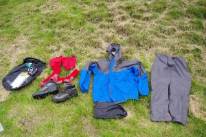
装備・持ち物
登山装備レンタル

登山ルート
高山病
天気
アクセス


コメント